| Maps: Policy Options | ||||||||||||||||||||||||||||||||||||||||||||||||||||||||||||||||||||||||||||||||||||||||||||||||||||||
|
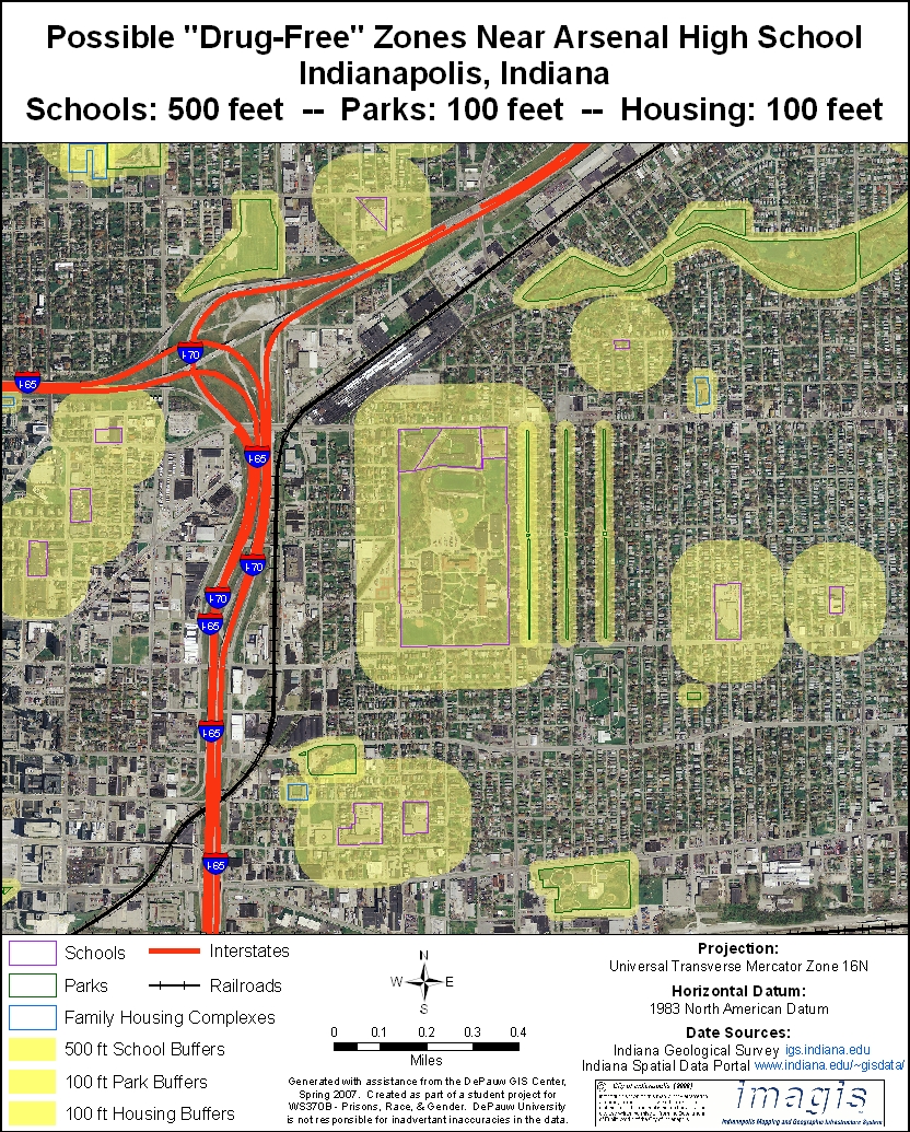
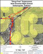
The goal in legislating "drug-free" zones is to deter drug dealing in certain areas, especially those frequented by children. This goal is undermined when zones are so large or so numerous that overlapping "superzones" are created. The original intent of the law can be preserved and strengthened by fine-tuning the size of the zones. To help visualize possible changes, we focus on two examples below involving specific neighborhoods and then provide a grid of maps showing the effect on the entire county of various combinations of zone sizes around different types of protected areas. ARSENAL HIGH SCHOOL Arsenal Technical High School is located just northeast of downtown Indianapolis. It adjoins several residential neighborhoods, but is also near an interstate highway, a railroad yard and a prison. The school itself (and thus the surrounding "drug free" zone) is quite large. The combination of that zone and a series of other intersecting zones around smaller schools and parks nearby creates a vast superzone blanketing much of the area, including the railroad yard and interstate. The original intent of providing special protection for children in schools by driving drug dealers further away is thus lost. That protection can be regained by shrinking the size of the zones, as illustrated below:
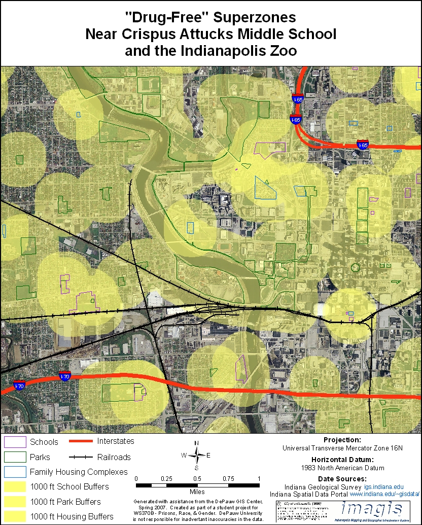
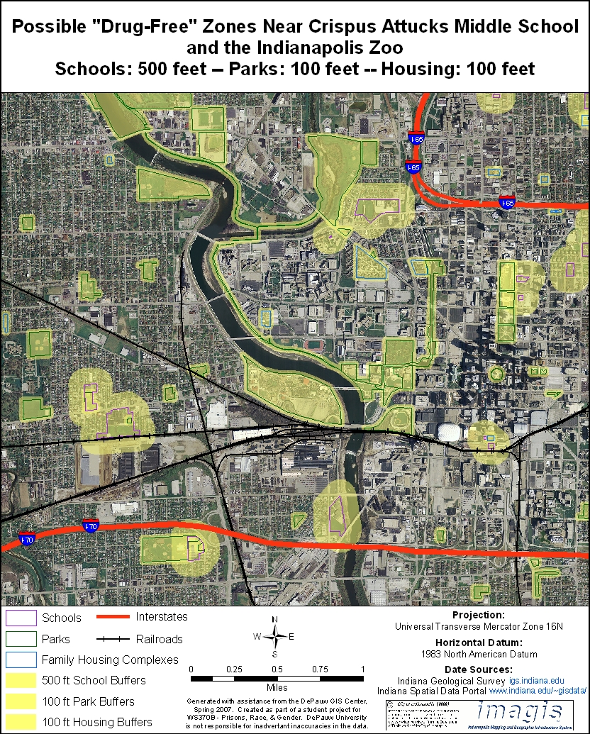
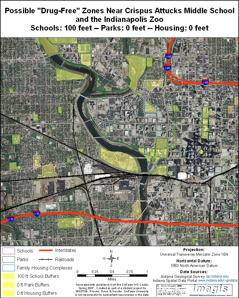
CRISPUS ATTUCKS MIDDLE SCHOOL The neighborhood near Indianapolis' historic Crispus Attucks Middle School provides another example. (During its long tenure as a racially segregated high school, Crispus Attacks achieved renown in the 1950s when Oscar Robertson led an all-black team to the fabled Indiana state basketball championship.) In the maps below, the school appears in the upper right corner next to the bend in Interstate 65. The many schools and parks lying west and south of Crispus Attucks cover most of the surrounding areas, which include not only residential neighborhoods, but also government and commercial buildings in downtown Indianapolis, industrial areas, interstates, railroads, the White River and the Indianapolis Zoo.
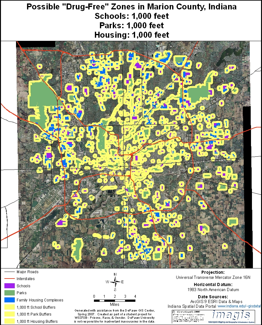
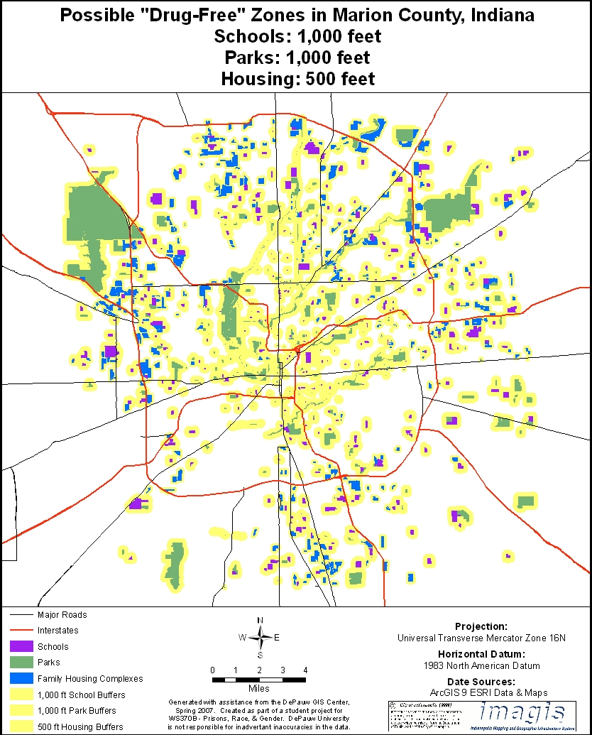
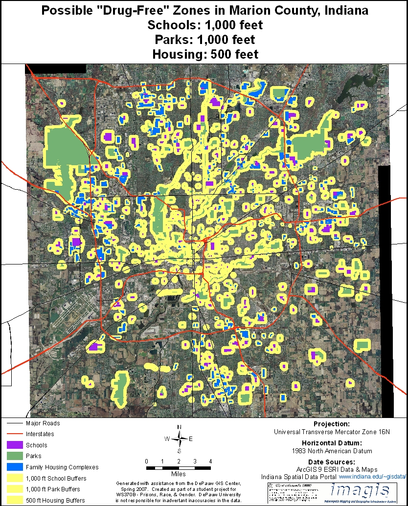
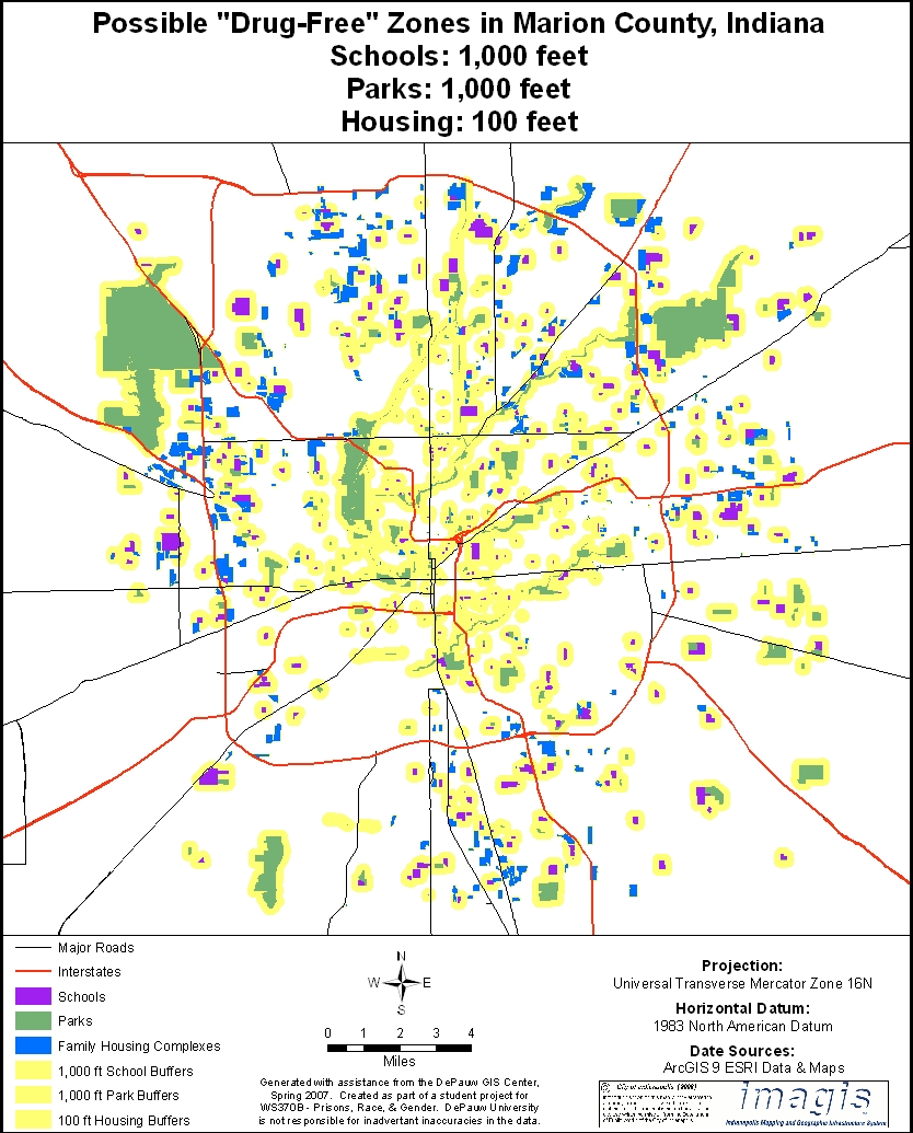
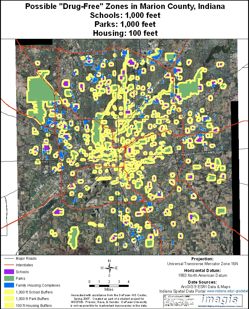
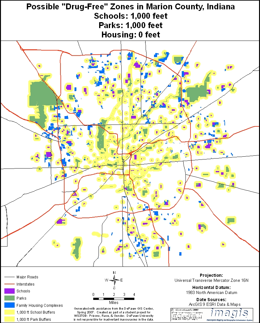
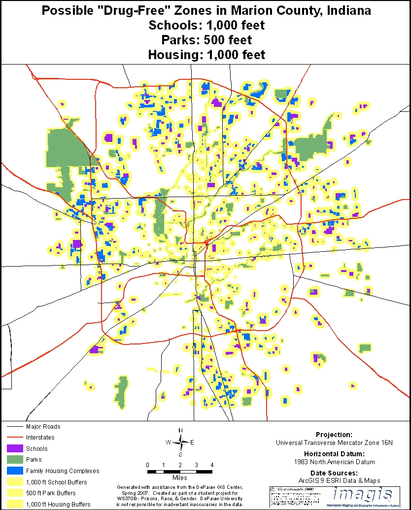
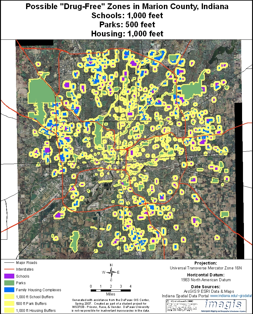
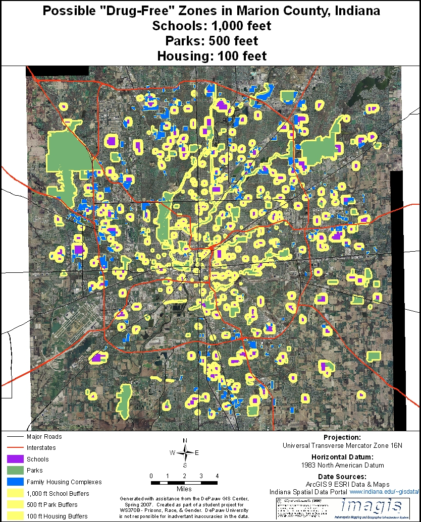
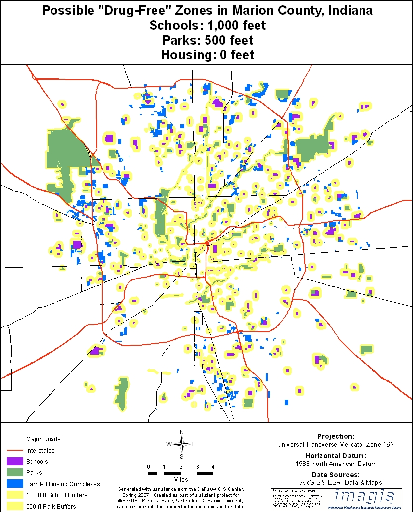
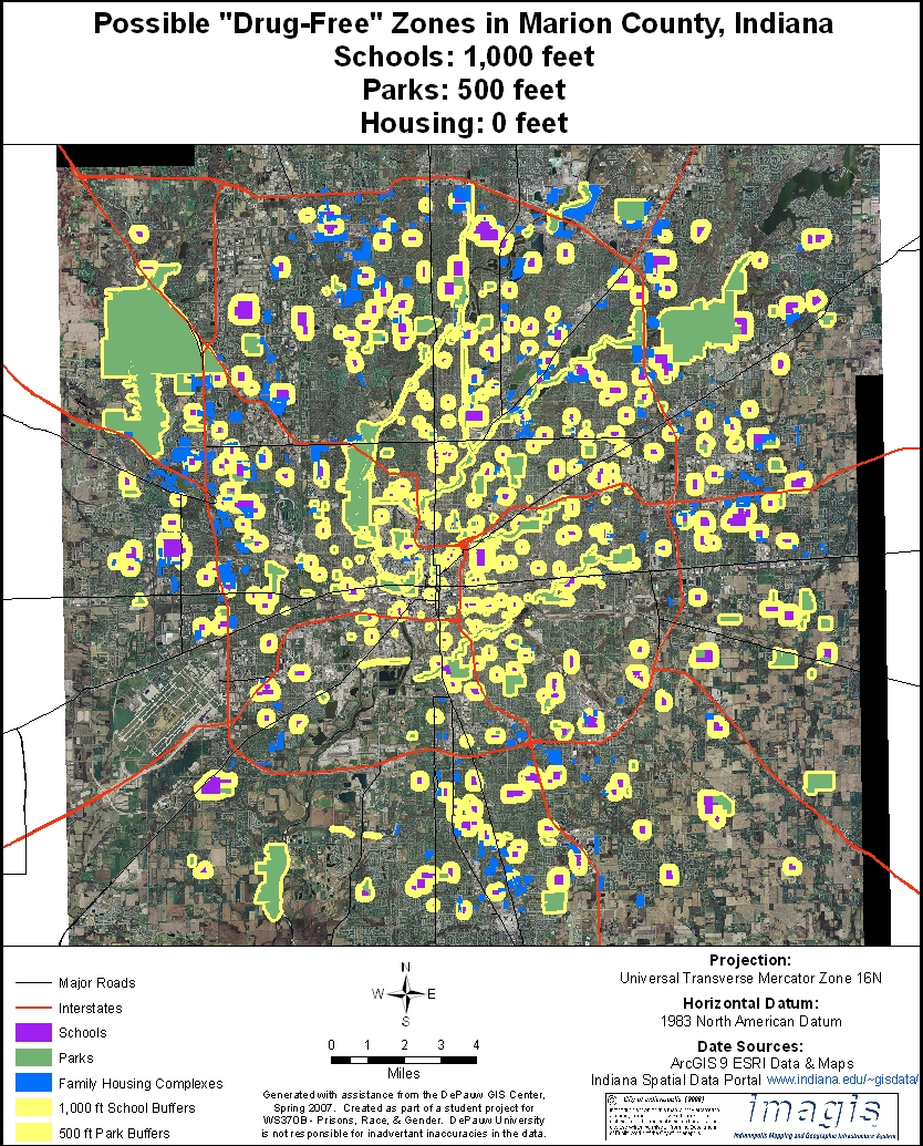
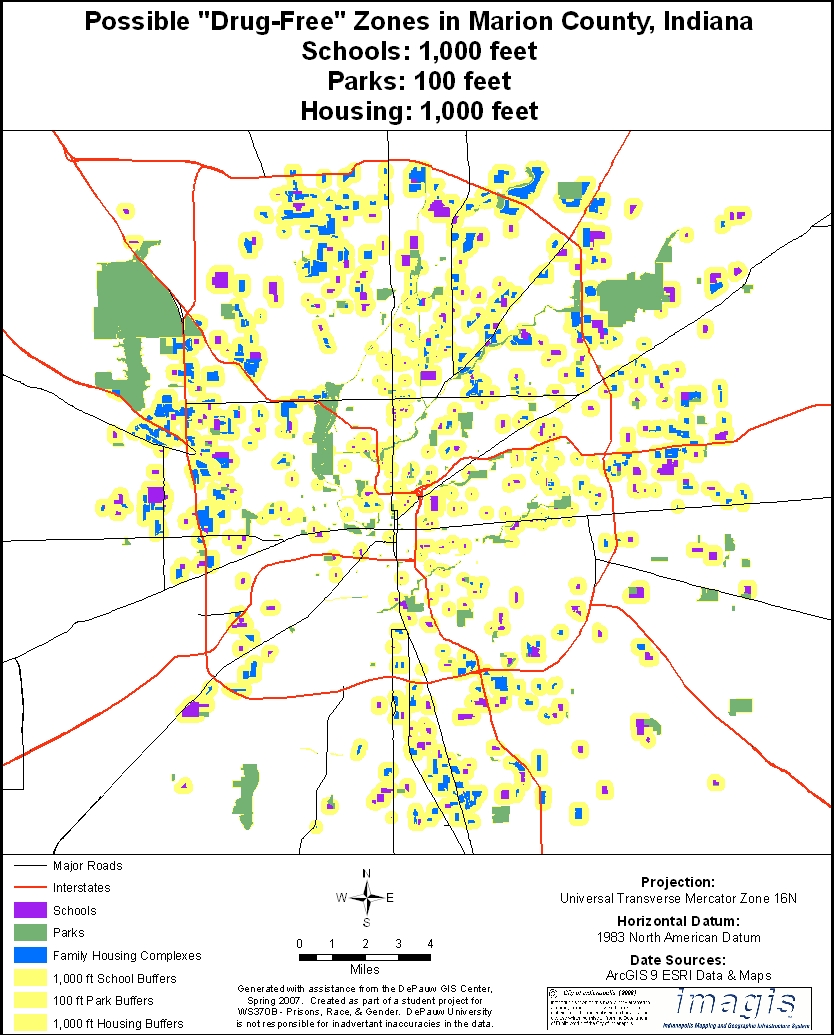
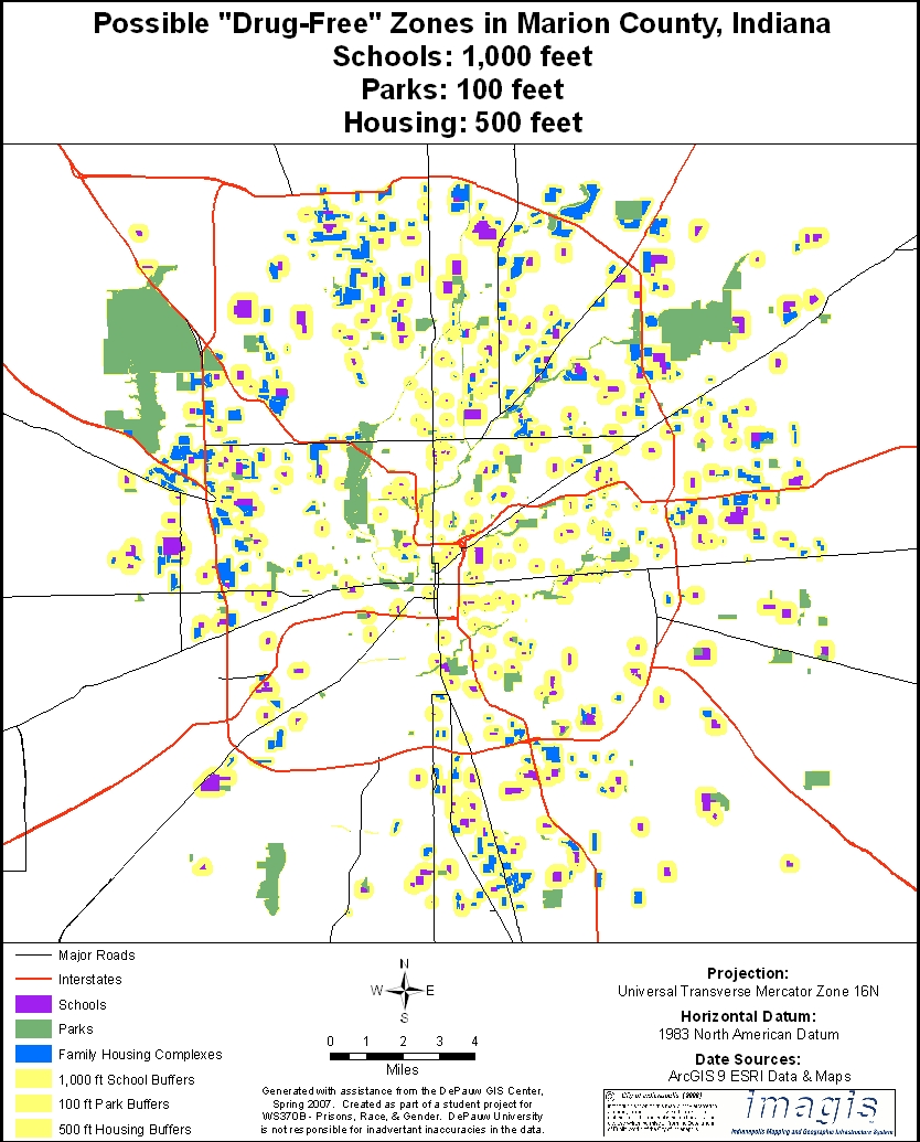
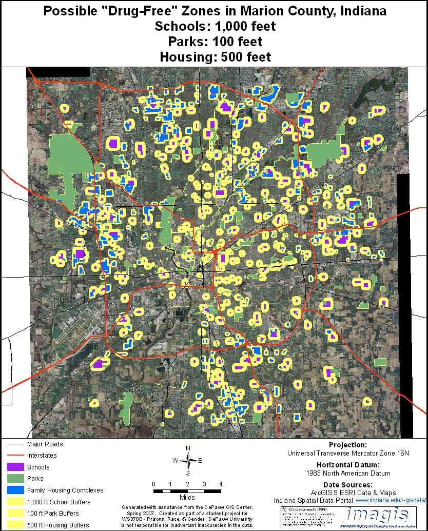
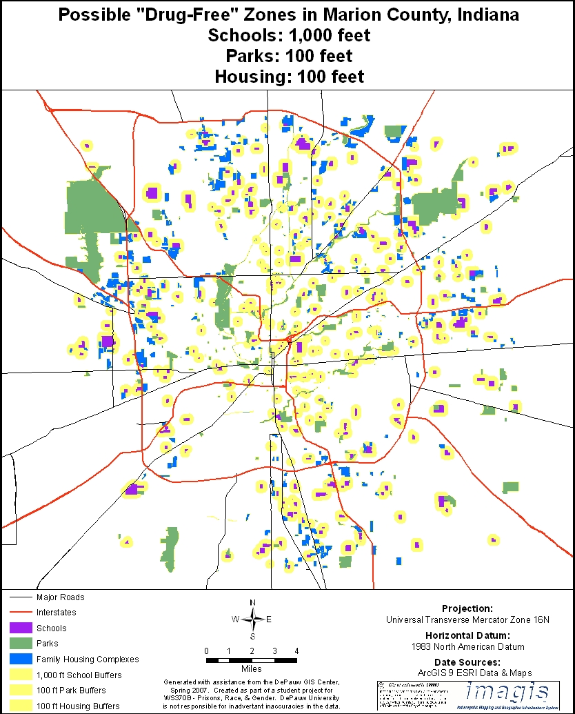
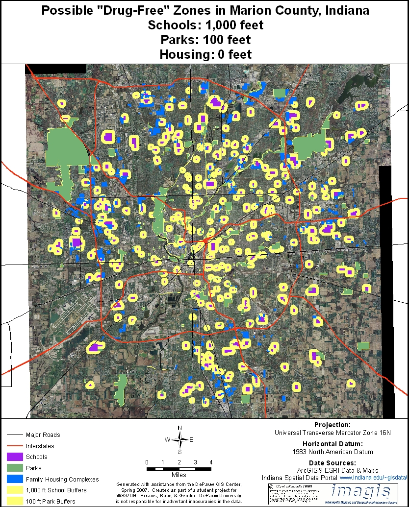
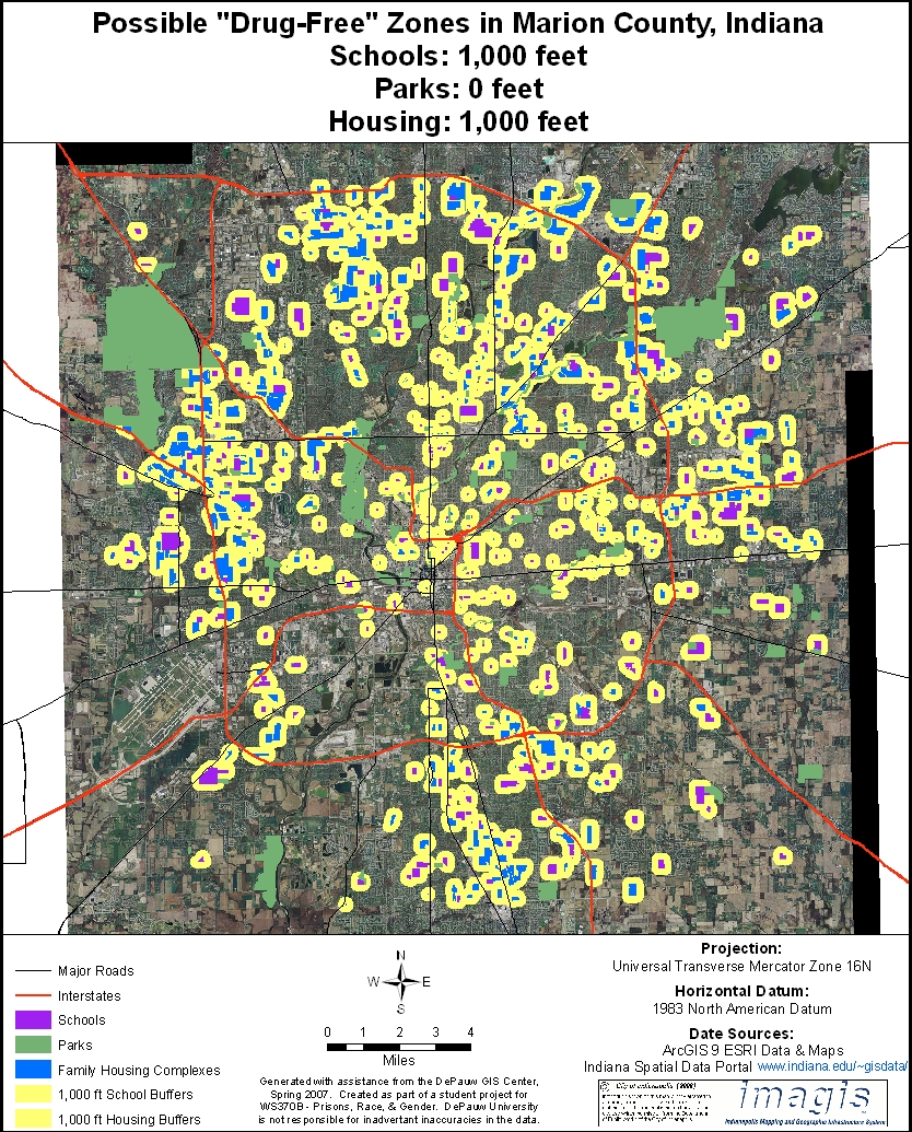
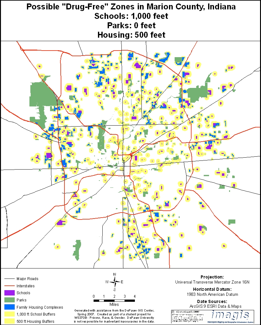
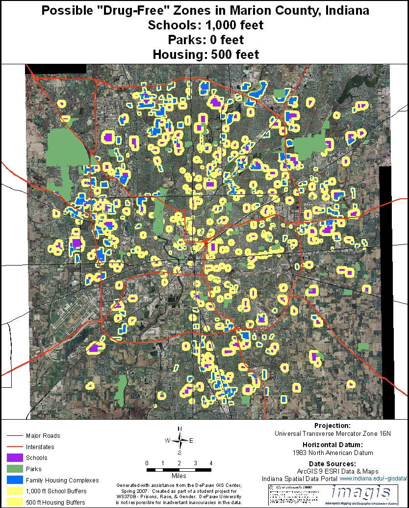
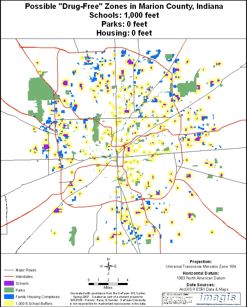
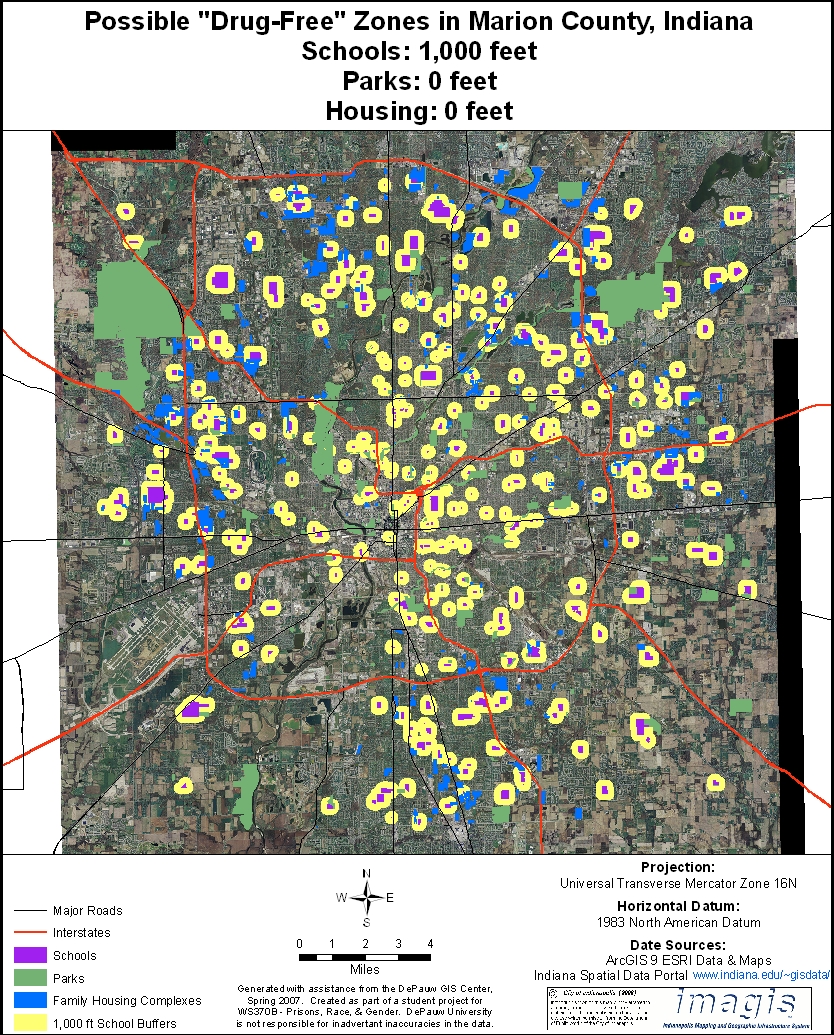
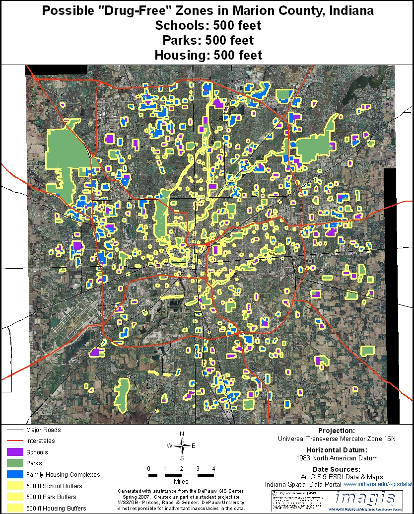
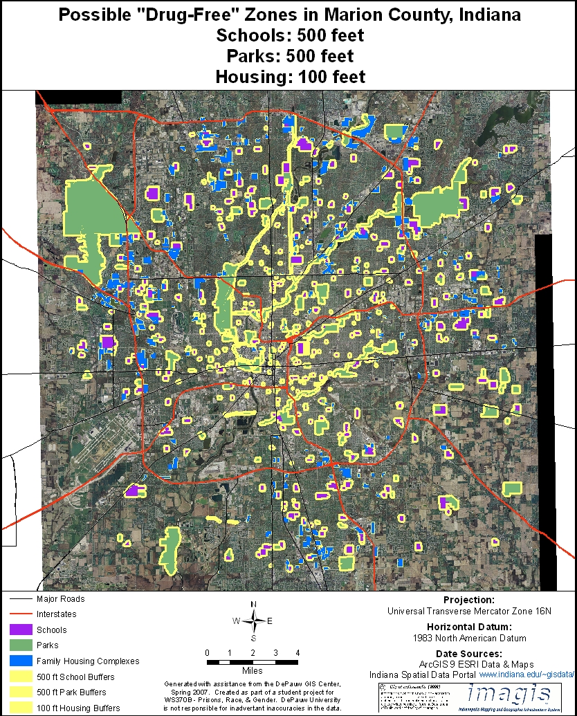
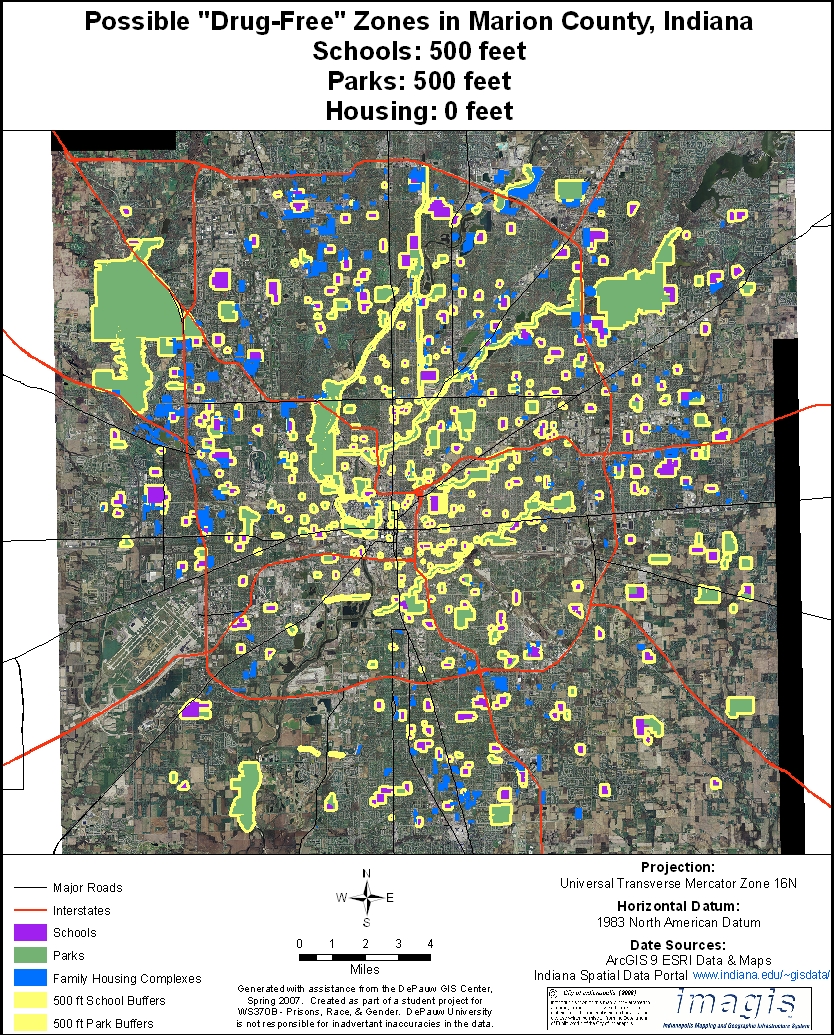
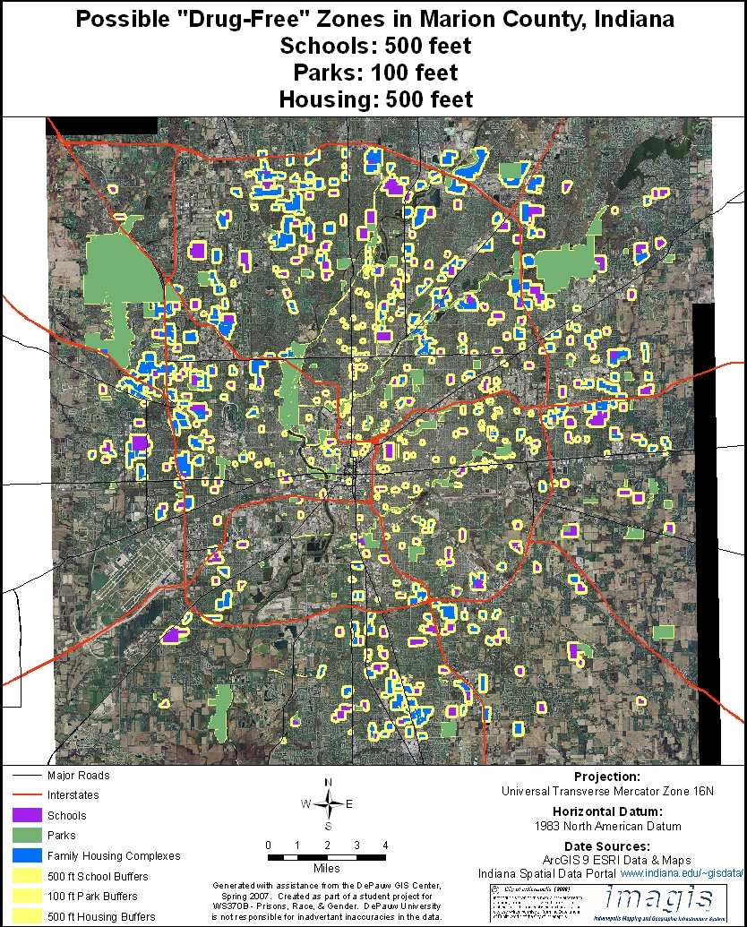
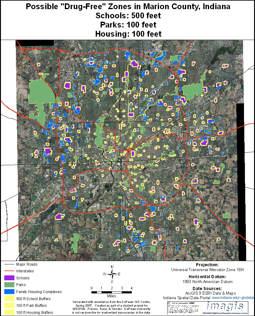
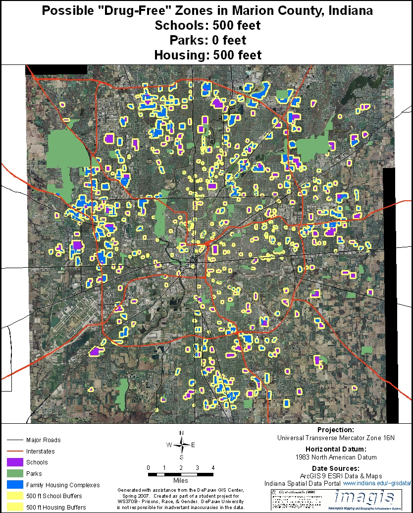
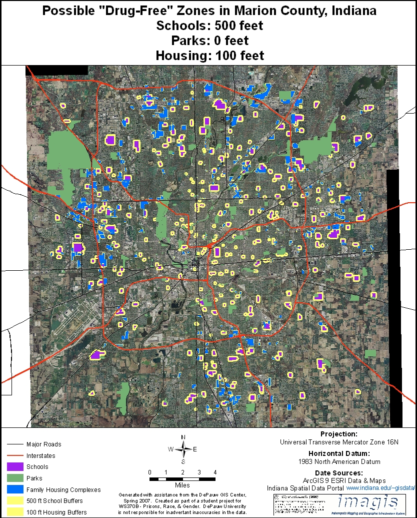
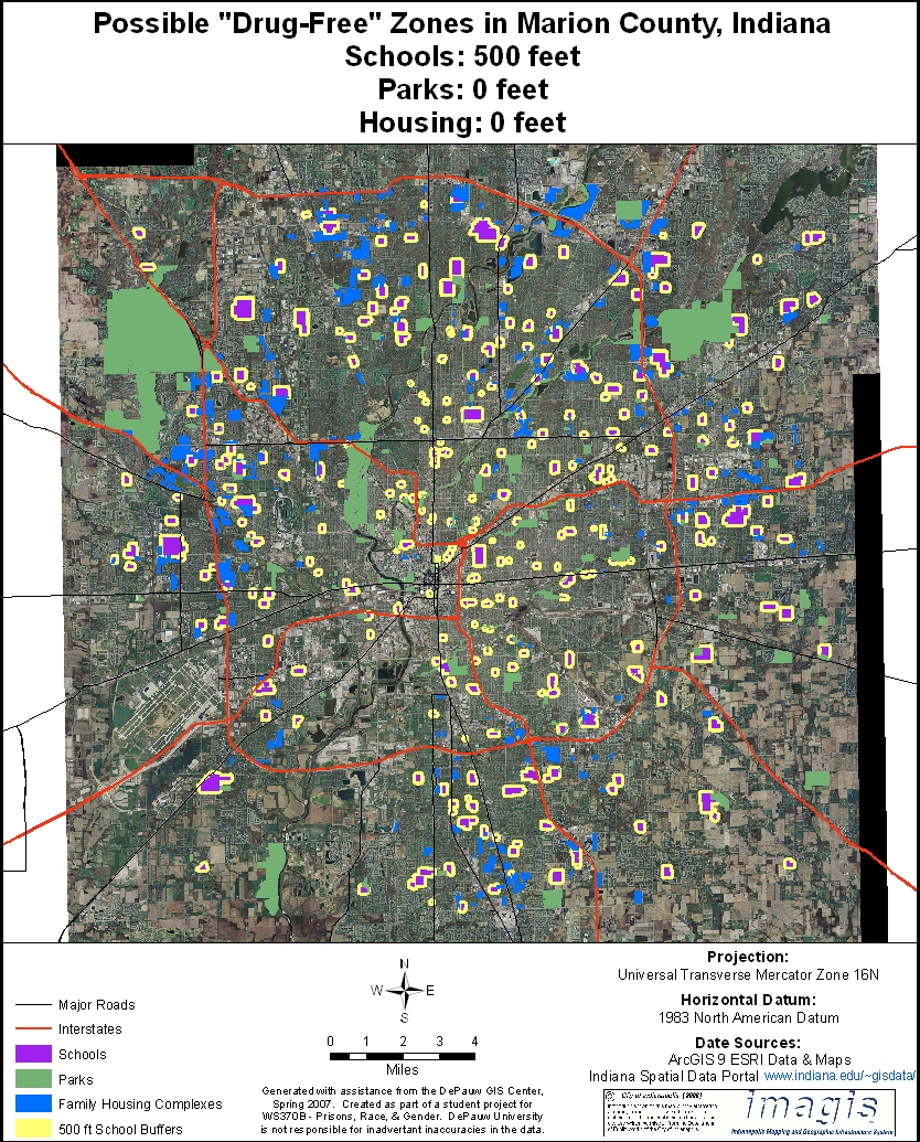
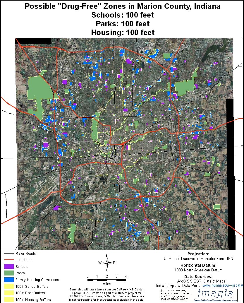
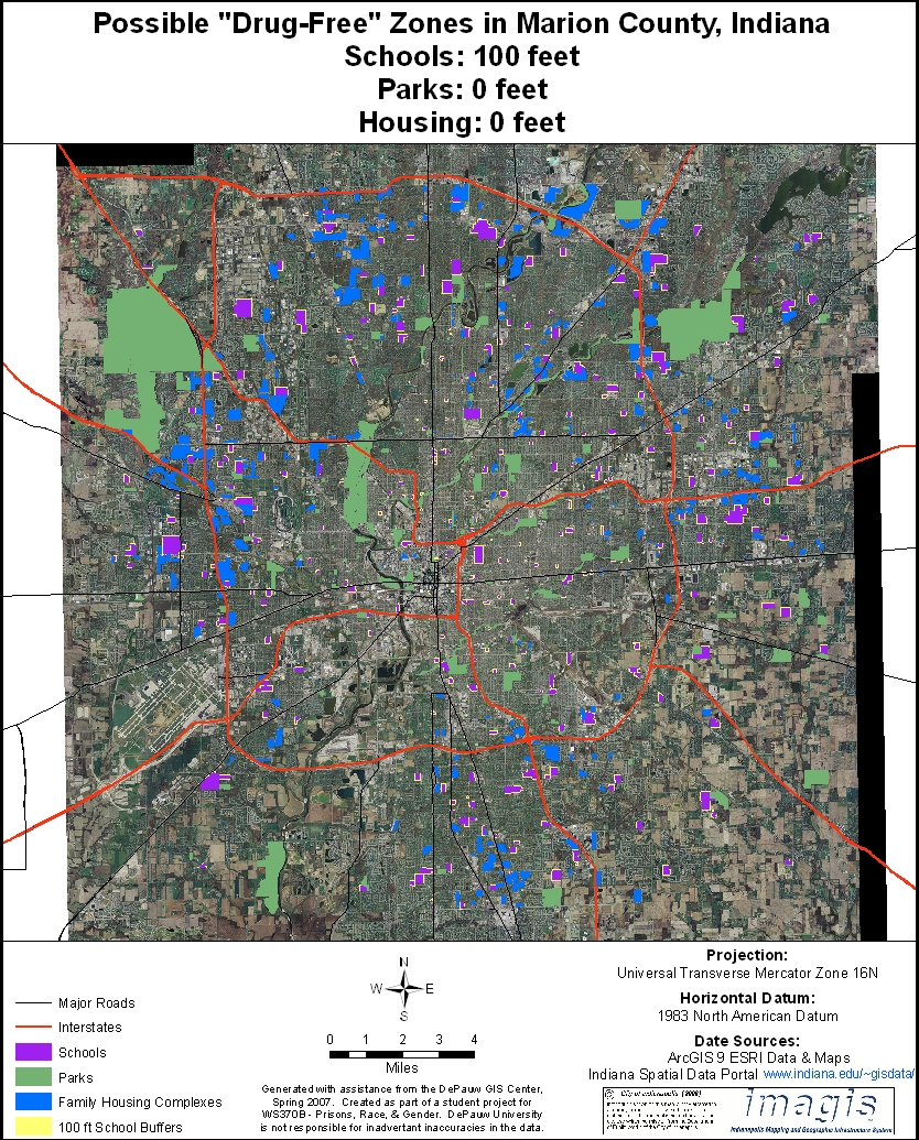
VISUALIZING POSSIBLE CHANGES To help policymakers visualize various options, we have provided three sets of maps below that demonstrate different combinations of zone sizes around schools, parks and housing complexes in Marion County. The first set of maps have 1,000 foot zones around schools, while the zones for parks and housing complexes vary from 1,000, 500, 100 and 0 feet. (Zero-foot zones are ones in which drug dealing within a park or housing development is a Class A felony, but dealing outside the park or housing development is not.) Note that the first map (upper left hand corner) represents current law with 1,000-foot zones around schools, parks and family housing complexes. With the second set of maps, zones around schools are 500 feet, while the zones for parks and housing complexes vary from 500, 100 and 0 feet. With the third set of maps, zones around schools are 100 feet, and zones around parks and housing developments are either 100 or 0 feet. (Since schools have historically been the primary focus of "drug-free" zone legislation, the size of zones around parks and housing developments on our maps are always equal to or less than the size of the zones around schools.) You can enlarge individual maps by clicking on them. ___________________________________________________________________ MAPS WITH 1,000 FOOT ZONES AROUND SCHOOLS IN MARION COUNTY
_______________________________________________________ MAPS WITH 500 FOOT ZONES AROUND SCHOOLS IN MARION COUNTY
_______________________________________________________ MAPS WITH 100 FOOT ZONES AROUND SCHOOLS IN MARION COUNTY
|
||||||||||||||||||||||||||||||||||||||||||||||||||||||||||||||||||||||||||||||||||||||||||||||||||||||