| Maps: Racial Impact of Indiana's "Drug Free" Zones | ||||||||
|
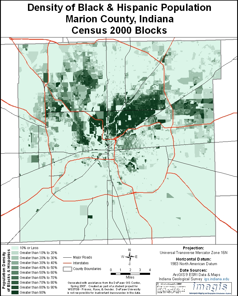
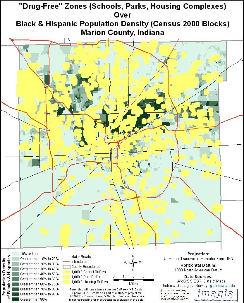
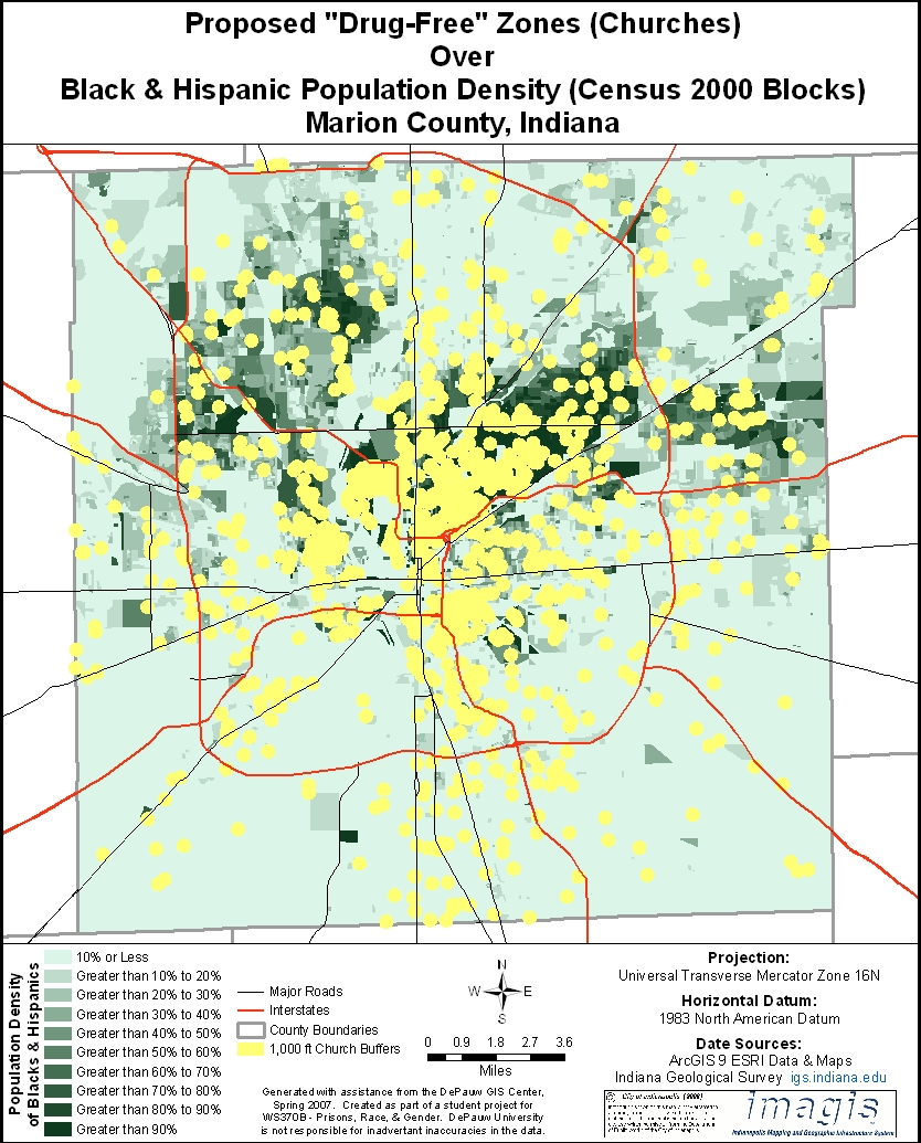
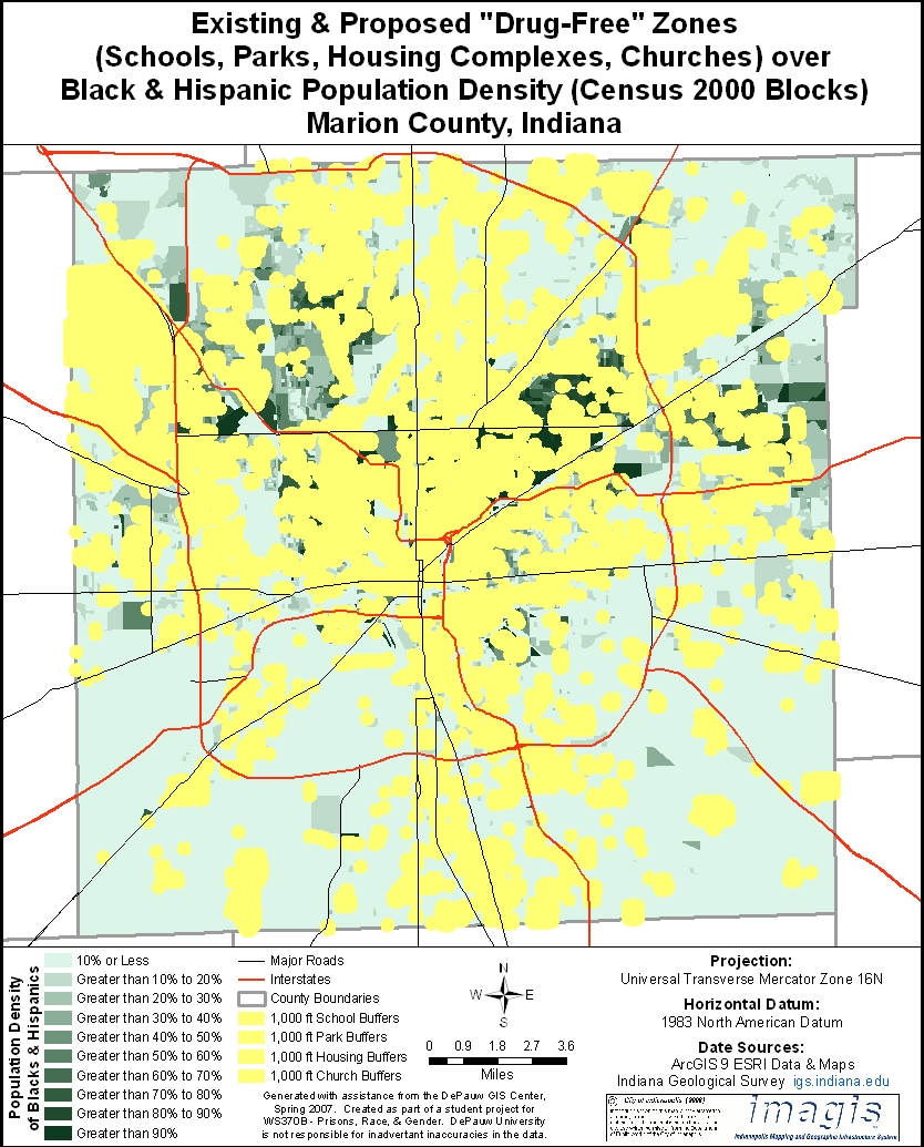
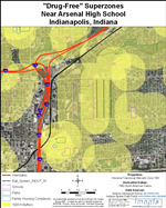
Studies conducted by the US Department of Justice have consistently found that black, Hispanic and white Americans use illicit drugs in roughly the same proportions. Yet most people serving time for drug offenses in the US are people of color. Our research and that of the New Jersey Commission to Review Criminal Sentencing indicate that this disparity is due in part to disproportionate impact of "drug-free" zone legislation on black and Hispanic communities. The maps below display "drug-free" zones in Marion County superimposed on census data showing racial composition of various neighborhoods. The first map displays census data in Marion County with percent of residents in various census blocks who are black or Hispanic. The second map superimposes current drug-free zones around schools, parks and housing complexes on the census map. The third map superimposes proposed drug-free zones around churches on the census map. The fourth map combines the first three maps. It demonstrates how adding churches to schools, parks and housing complexes would create a vast superzone covering nearly all black and Hispanic neighborhoods in Indianapolis.
|